


National Geographic Canada|Wandelkaart 215 Glacier NP
Original price was: €16.56.€11.95Current price is: €11.95.
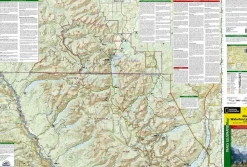
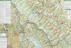
Topografische wandelkaart, scheurbestendig en watervast, van de Nationale Parken Glacier en Waterton Lakes.
-gedrukt op waterproof en scheurbestendig papier
-met ingetekende wandelpaden en campsites
-schaal 1:100.000 (1 cm = 1 km)
-hoogtelijnen
-mooi kleurgebruik
Seeking the best combination of detailed maps and value for your Glacier/Waterton Lakes National Parks trip, then get our bundle pack. It includes three of our Glacier/Waterton Lakes National Parks sectional Trails Illustrated maps, providing you coverage of the entire map region, while saving you over 15%. Like all Trails Illustrated maps, the Glacier/Waterton Lakes National Parks Bundle set is frequently revised and printed on waterproof, tear-resistant material to stand up to all conditions. This detailed topographic recreation map bundle contains carefully researched trails, campsites, forest service roads, and points-of-interests. Includes UTM grids for use with your GPS unit.
Coverage includes: Glacier National Park, Waterton Lakes National Park, North Fork, Many Glacier, Two Medicine, Pacific Northwest Trail and more.
Bekijk alle
PRODUCTINFORMATIE NATIONAL GEOGRAPHIC WANDELKAART 215 GLACIER NP
Be the first to review “National Geographic Canada|Wandelkaart 215 Glacier NP”
Related products

Boeken & Kaarten
Boeken & Kaarten
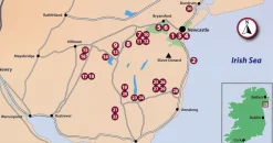
Collins Groot-Brittanië & Ierland|Walking guide to Northern Ireland
Boeken & Kaarten
Boeken & Kaarten
Boeken & Kaarten
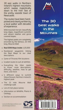
Knife Edge Groot-Brittanië & Ierland|Wandelgids Northern Ireland – The Mourne Mountains
Boeken & Kaarten
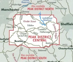
Harvey Maps Groot-Brittanië & Ierland|Wandelkaart Ultramap XT40 Peak District Central
Boeken & Kaarten
Login
Reviews
There are no reviews yet.