

Cicerone Groot-Brittanië & Ierland|Wandelgids walking the Southern Upland Way
Original price was: €21.16.€15.63Current price is: €15.63.
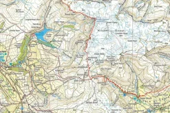
Praktische, Engelstalige wandelgids van The Southern Upland Way. Deze wandelroute loopt over 124 kilometer. Met beschrijving, accommodatie en zeer handige los uitneembar kaartgids met de route op Ordnance Survey 1:25.000 topografische kaarten ingetekend.
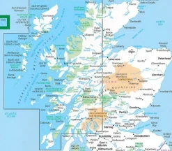
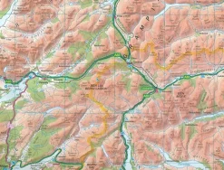
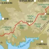
Guidebook to the Southern Upland Way, a coast to coast walk through Galloway and the Scottish Borders. One of Scotland’s Great Trails, the 347km (215 mile) route links Portpatrick on the west coast to Cockburnspath on the east, through diverse landscapes and rich natural and historical interest. It can be completed in around a fortnight.
Seasons
April to September, with May and June the best months of all
Centres
Portpatrick, Castle Kennedy, New Luce, Bargrennan, St John’s Town of Dalry, Sanquhar, Wanlockhead, Beattock/Moffat, Traquair, Galashiels, Melrose, Lauder, Longformacus, Abbey St Bathans, Cockburnspath
Difficulty
The route is waymarked throughout, and paths are mostly good, but much of the hill country is remote and little frequented and in places the path is faint. Self-reliance and some navigation skills are required. For backpackers, the route has 5 bothies and unlimited wild camping possibilities. For walkers, maximum daily stages of up to 19 miles (30km) are assured by using vehicle pick-up services, as detailed in the book.
Must See
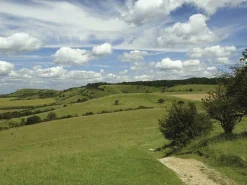
Portpatrick coast path; Loch Trool; Lowther Hills; Minch Moor drove road; Lammermuir Hills; new official high-level route through the Ettrick Hills; Castle Kennedy Gardens; Wanlockhead Lead Mines; Melrose Abbey; Thirlstane Castle
Bekijk alle
PRODUCTINFORMATIE CICERONE WANDELGIDS WALKING THE SOUTHERN UPLAND WAY
Be the first to review “Cicerone Groot-Brittanië & Ierland|Wandelgids walking the Southern Upland Way”
Related products
Boeken & Kaarten
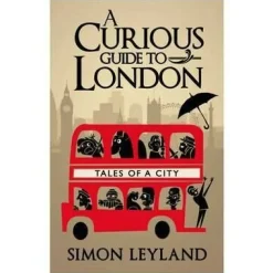
Bantam Press Groot-Brittanië & Ierland|A Curious guide to London


Boeken & Kaarten
Freytag en Berndt Groot-Brittanië & Ierland|Wegenkaart Schotland


Boeken & Kaarten
Boeken & Kaarten
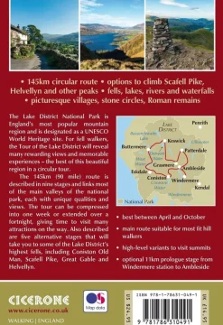
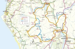
Cicerone Groot-Brittanië & Ierland|Wandelgids Walking the Tour of the Lake District
Boeken & Kaarten
Boeken & Kaarten
Harvey Maps Groot-Brittanië & Ierland|Wandelkaart Ultramap XT40 Yorkshire Dales South West
Boeken & Kaarten
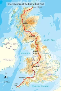
Cicerone Groot-Brittanië & Ierland|Wandelgids End to End Trail
Boeken & Kaarten
AA Publishing Groot-Brittanië & Ierland|50 Walks in Warwickshire & the West Midlands
Boeken & Kaarten
Boeken & Kaarten
Login
Reviews
There are no reviews yet.